Updated: Tuesday, April 2, 2024 at 1:45pm
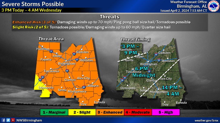
There is a Enhanced Risk (Level 3 out of 5) for severe thunderstorms for East Alabama and West Georgia.
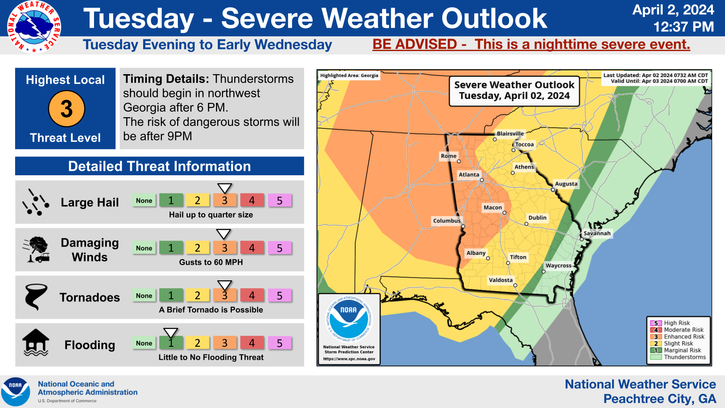
Confidence is growing for a strong overnight system to produce severe weather over Georgia. An Enhanced Risk (level 3 of 5) has been expanded to include a larger area, including portions of the Atlanta metro, Columbus and Macon. A Slight Risk (level 2 of 5) continues for the remainder of north and central Georgia. Damaging winds, isolated tornadoes, hail up to one inch or more, and frequent lightning will be the primary threats. Stronger storms may also produce locally heavy rain. Although storms could move into northwest Georgia as early as 6 PM, the highest threat will be after 9 PM, continuing overnight through sunrise Wednesday.
WHERE & WHEN:
- A line of storms is expected to progress eastward between 11PM and 2AM through East Alabama and West Georgia.
- Showers/thunderstorms will come to an end by Wednesday morning as the cold front moves into southeast Georgia.
IMPACTS:
- Severe thunderstorms that develop will be capable of producing:
- Damaging wind gusts >60mph
- A few tornadoes
- Hail up to 1 inch
- Rainfall totals are forecast to range from 0.5 to 1 inch across the majority of East Alabama and West Georgia
- Stronger storms could produce locally higher rainfall amounts.