From Carroll County EMA Director Tim Padgett:
The National Weather Service (NWS) held a Special Weather Briefing Monday afternoon to update the Winter Weather situation for East Alabama and West Georgia.
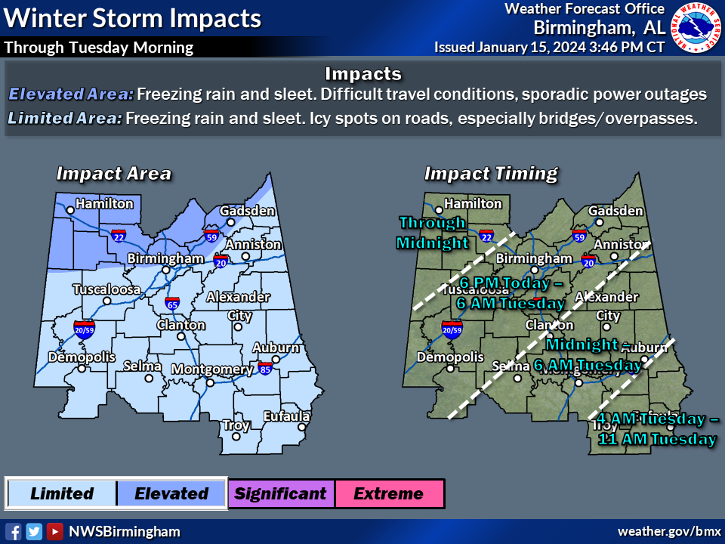
- The Winter Weather Advisory has been extended to include Randolph County in East Alabama and Carroll, Doulgas and Paulding Counties in West Georgia. Cleburne County in Alabama and Haralson County were in the original advisory.
- Alabama Counties – Midnight tonight until 6:00 am CST Tuesday
- Georgia Counties – 4:00 am Tuesday morning until 12:00 noon Tuesday.
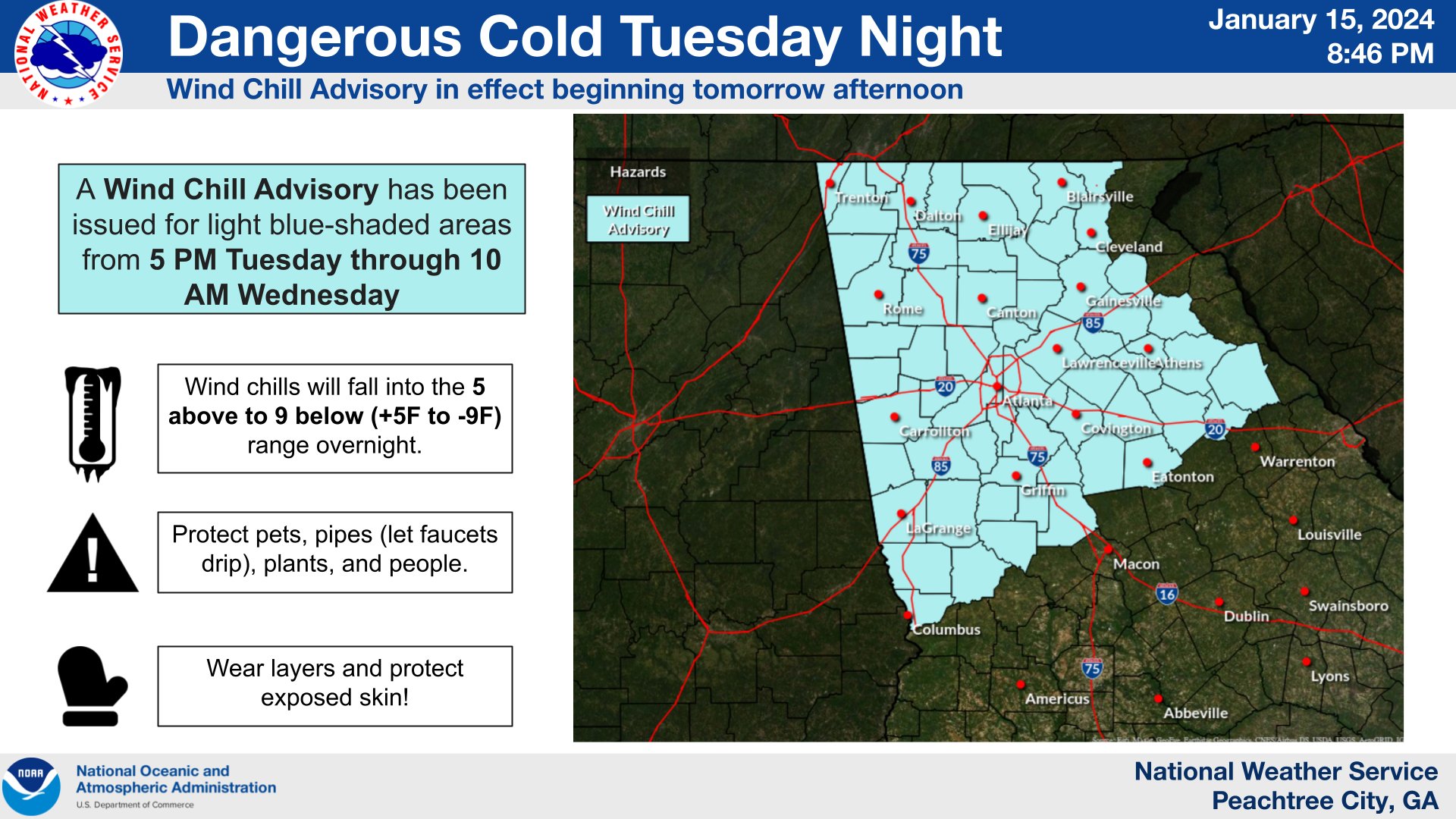
- A Wind Chill Advisory will be issued for our area Tuesday for Tuesday Night into Wednesday for temperatures near 12 degrees and wind chill temperatures near 0 degrees.
Early Tuesday morning temperatures will begin to fall from the 30”s into the low 20’s as light precipitation moves into the area. This light precipitation will be mostly freezing rain, possibly mixed with sleet. Accumulations of ice are currently forecast to be near or less than a tenth of an inch which would mainly affect untreated bridges and overpasses causing slick spots. Accumulations of ice great than a 10th of an inch could result in damage to trees and power lines.
Late Tuesday afternoon into Tuesday evening an arctic air mass will move into the area bringing lows in the area to the low teens and wind chills near 0.
Click here to view a PDF of the slide deck from NWS for additional graphical information.
Please monitor this changing winter weather situation. We will provide updates with any additional forecast changes.