PEACHTREE CITY – Multiple weather hazards are expected across north and central Alabama and Georgia tonight through Saturday night. Showers and thunderstorms are expected across central Alabama and Georgia along a warm front approaching from the Gulf Coast this afternoon/evening. In addition, a cold front approaching from the west will also impact north and central Alabama and Georgia tonight/Saturday that will bring a variety of hazardous weather threats including isolated thunderstorms, the potential for winter precipitation, gusty winds, and freezing temperatures through Sunday morning. Below is an outline of what to expect.
Tonight (hazards/impacts):
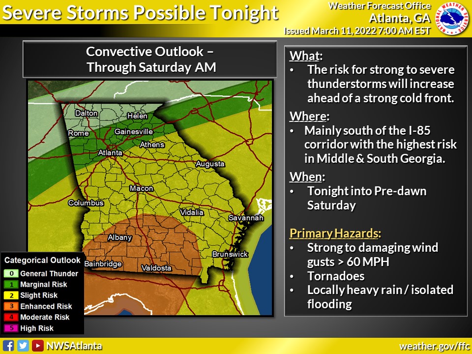
- Showers and thunderstorms will develop and overspread the area by this evening with locally heavy rain and gusty winds expected.
- Mainly after midnight tonight — Strong to severe thunderstorms anywhere along and south of I-85. Primary threats with any storms:
- Damaging wind gusts (primary threat)
- Tornadoes
- Heavy rainfall that could lead to localized flooding concerns, especially in low-lying areas and in areas with poor drainage
Saturday’s weather: *hazardous weather threats are expected on Saturday through Saturday night*
- A line of showers and potentially strong to severe storms should be rapidly exiting our far southeast counties with the risk for any severe weather done by 9AM.
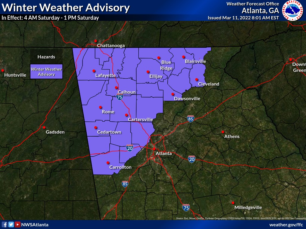
- Rain will quickly mix with/change to snow with accumulations possible generally northwest of a line from Carroll -> Cherokee -> Towns Counties
- Rain/snow mix possible starting around 3am in the furthest NW counties through 5am in furthest NE counties.
- Snow flurries may linger through Saturday afternoon
- Accumulations of 1-2″ expected across NW GA, decreasing to trace to 1″ amounts for the rest of the Winter Weather Advisory area
- Frigid temperatures Saturday morning and again overnight Saturday/Sunday morning
- Temperatures drop into low 20s to low 30s over portions of north and west Georgia Saturday morning
- Temperatures drop to the high teens to low 20’s Sunday morning
- A hard freeze is likely Saturday night/Sunday morning for all of north and central Georgia
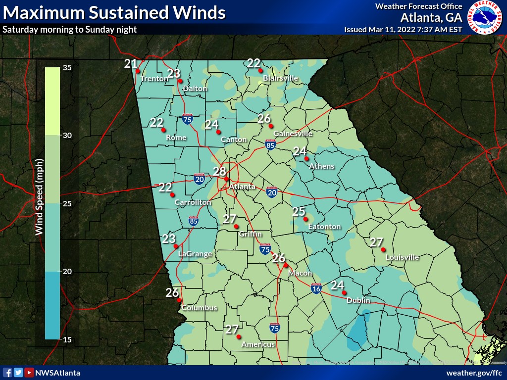
- Strong/Gusty winds will occur early Saturday morning through the evening hours
- Sustained winds of 20-30 mph with gusts 30-45 mph at times